When electronic chart display and information systems, or ECDIS, became mandatory on all ships, it not only opened a technology door for the industry but paved the way for a set of standards that created fresh opportunities for businesses, including shipowners.
These standards include product specifications and extend much further than how an ECDIS will be used. Experts believe it will bring about huge developments in maritime as data becomes machine-readable rather than focused on how it is displayed on a digital chart.

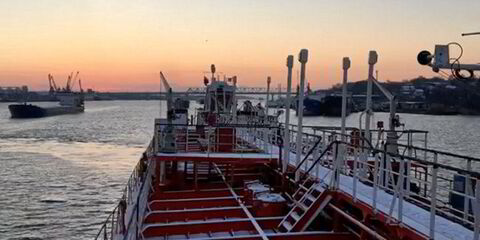
ECDIS is a bridge tool for passage planning and navigation that replaced paper charts and can draw on additional information, such as proposed routes, weather information and other vessel and navigation information garnered via multiple sources including radar and AIS.
In 2022, a framework standard for these technological and communication building blocks became mandatory.
The standard S-100 was developed by the International Hydrographic Organization and includes a whole series of product specifications such as weather and route reporting, and tidal and bathymetric information.
From 1 January 2029, all new ECDIS must be built with S-100 capabilities, and manufacturers can do so voluntarily from January 2026.
S-100 is not new. Work began in 2010 to replace an older standard that was primarily for encoding electronic navigation charts and supporting additional data layers, data sources and customers. But now it is being given teeth.
Magnus Wallhagen, Sweden’s National Hydrographer and chair of the IHO Hydrographic Services and Standards Committee, likened the S-100 to a popular children’s toy.

“You can compare it to Lego, where S-100 is the idea and the product specifications for tide height, weather, routes etc, are the bricks,” he said.
Nick Chubb, founder and strategy director at maritime technology research consultants Thetius, said S-100 has implications across the maritime domain awareness space, and in navigational safety and voyage optimisation. But he added that the biggest change will be in the development of autonomous systems.
A recently published report from Thetius points to a 42% year-on-year investment in digital hydrographic solutions since the S-100 standard was approved at the International Maritime Organization in November 2022.
Voyage reporting and routing benefits
S-100 comes with a range of product specifications that will become operational in the coming years, covering surface currents, tides, under keel clearance, real tide heights, aids to navigation such as lights and fairways, and route plan sharing or exchange.
The latter has now been provisionally agreed at the IMO.
The standard’s proponents say it will allow vessel traffic operators working ashore and bridge teams on ships to gain the benefits of sharing the data, and give shipping companies a common approach to do so with ports, charterers and others.
Fredrik Karlsson of the Swedish Maritime Authority, who is leading its work on route reporting, said the specifications will be a significant step in facilitating autonomous navigation as it allows machine-to-machine information exchange.
The standards will allow for route amendments to be updated automatically, and for times of arrival at specific waypoints and the end of passage to be monitored.
While ECDIS will eventually be built incorporating the S-100 framework standard, around which its functionality will be based, there will be no requirement for route exchange to be used. Rather, the government agency in Sweden and others want to see it being so beneficial to shipowners, ports and vessel traffic service operators that its use becomes a de facto standard.
You can compare it to Lego, where S-100 is the idea and the product specifications for tide height, weather, routes etc, are the bricks
— Magnus Wallhagen
Wallhagen added that a common format for sharing routing data will help with the push for just-in-time arrival so vessels do not consume more fuel than needed.
Karlsson has worked for many years as a seafarer, in search and rescue, and in Sweden’s Vessel Traffic Services for the maritime authority.
“Navigation officers need to plan a route before the vessel leaves the quay, that’s already mandatory, even if it does not need to be shared,” he noted.
He added that if ship operators and ports begin sharing information on various timings such as arrivals at waypoints and fairways and see these benefits, they can then start sharing the routes, thus understanding the business benefits and the added security and safety.
The move towards just-in-time arrival, or smart sailing, where ports and vessels share arrival and berth availability data automatically has been a discussion topic with the industry for many years, not just because it saves fuel by allowing vessels to sail at more optimal efficient speeds, but it allows vessels to time their arrival for berth availability. This of course reduces anchoring time and demurrage costs.
The specifications will also benefit how shipping companies can access standard weather routing and voyage optimisation information, a change that could have an impact on the optimisation market where many companies remain focused on manually compiled noon reports.
The key to route exchange
The development and mandatory rollout of S-100 into equipment may not seem an immediate benefit to shipowners other than those relating to navigation safety in an ECDIS. Still, Chubb said the opportunities in the coming decade can be significant.
He cites the potential of the S-100 framework standard alongside the development of a newer extension of the AIS that is under development. This is the VHF Data Exchange System (VDES).
The International Association of Lighthouse Authorities defines VDES as “a radio communication system that operates between ships, shore stations and satellites on AIS, Application Specific Messages and VHF Data Exchange frequencies in the Marine Mobile VHF band”.
Chubb said it is the tool by which S-100-compliant vessel route information can be shared, and importantly, will enable the development of autonomous systems away from ECDIS, which is a human interface tool.
Karlsson also points to another recently approved tool, an application programming interface known as SECOM, the International Electrotechnical Commission’s Secure Communication between Ship and Shore, which has been designed for S-100 information.
All of these digital standards and specifications are key enablers of the evolution of autonomous solutions in maritime, and, as Chubb also noted, a link between shipping and other marine sectors that are also able to use the same tools.